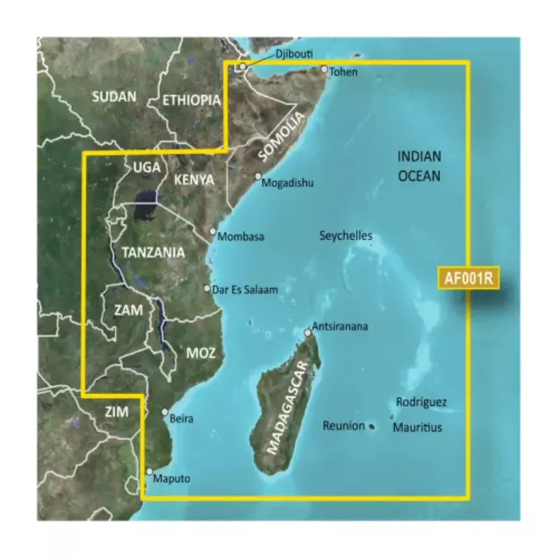
Garmin Cartography Africa Eastern Coastal & Inland Charts with MicroSD/SD, Advanced Chart Detail, Depth Range Shading, Detailed Contours, G3 HXAF001R 010-C0747-20
010-C0747-20
Factory/Distributor Prices
Avoid haggling or being price-gouged! Find the best value with fair prices straight from distributor/manufacturer
Get the correct product
Pay however you like
Delivery throughout Tanzania
Our Advanced Chart Offering
- Derived from official charts and private sources to provide navigational aids, spot soundings, depth contours, tides and currents, and detailed harbors and marinas
- Depth Range Shading for up to 10 depth ranges enables you to view your target depth at a glance
- Up to 1-foot contours provide a more accurate depiction of the bottom structure for improved fishing charts and navigation in swamps, canals and marinas
- Shallow Water Shading feature allows for depth shading at a user-defined level to aid in navigation
- Worldwide coverage available
- Keep your charts up to date with our industry-leading New Chart Guarantee and discount card update program
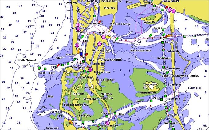 Advanced Chart Detail
Detailed charts help the mariner guide their boat in and out of port with confidence.
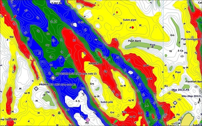 Depth Range Shading
Displays high-resolution Depth Range Shading for up to 10 depth ranges so you can view your designated target depth.
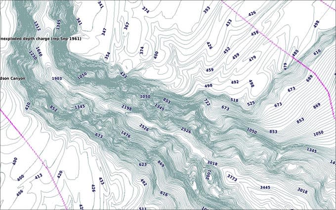 Detailed Contours
BlueChart g3 HD features 1-foot contours that provide a more accurate depiction of bottom structure for improved fishing charts and enhanced detail in swamps, canals and port plans.
Specifications:
g2 HD:
- 1' HD Contours
- Depth Range Shading
- Shallow Water Shading
- Navigational aids, spot soundings, depth contours, tides and currents, and detailed harbors and marinas
g2 Vision HD:
- 1' HD Contours
- Depth Range Shading
- Shallow Water Shading
- Navigational aids, spot soundings, depth contours, tides and currents, and detailed harbors and marinas
- Auto Guidance
- 3-D Views (MarinerEye & FishEye)
- High Resolution Satellite Imagery
- Aerial Photography
- Detailed coastal roads up to 5 miles inland
No reviews found
Please sign in so that we can notify you about a reply