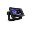
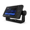
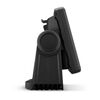
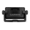
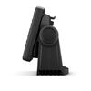
Garmin ChartPlotter Combo ECHOMAP UHD 62cv 6" Display with GT24-TM Transducer, Optional Charts and Maps, Quickdraw Contours, Activecaptain App, WW, w/GT24 xdcr 010-02329-01


Avoid haggling or being price-gouged! Find the best value with fair prices straight from distributor/manufacturer
JOIN THE CLUB. FIND MORE FISH.
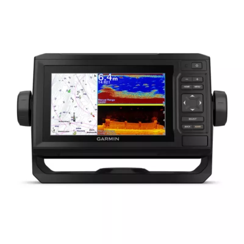
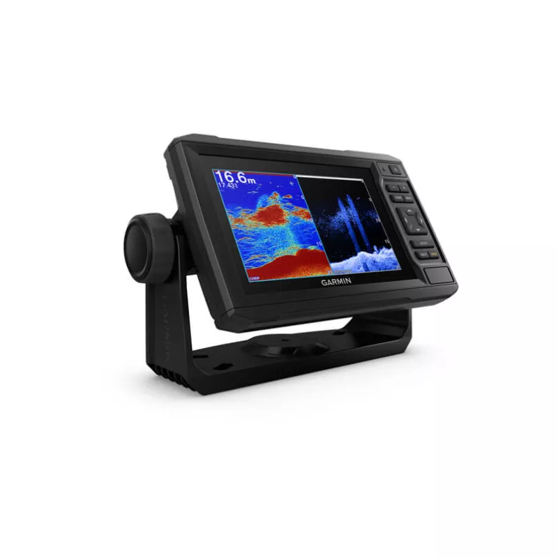
The sunlight-readable 6” touchscreen chartplotter features a quick-release bail mount, and the transducer bundle adds Ultra High-Definition scanning sonar and CHIRP traditional sonar.

![]() See below your boat in incredible detail with optional transducer
See below your boat in incredible detail with optional transducer
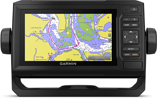
![]() Navigate any waters with optional charts and maps
Navigate any waters with optional charts and maps
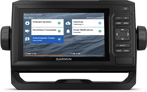
![]() Manage your marine experience from nearly anywhere
Manage your marine experience from nearly anywhere
![]() Create your own maps on the fly and tailor them to fit your needs
Create your own maps on the fly and tailor them to fit your needs
Key Features:
OPTIONAL TRANSDUCER BUNDLE
Select the transducer bundle to add a GT24 transducer for Ultra High-Definition ClearVü scanning sonar, which shows you a crystal-clear image below your boat. Plus, you get Garmin high wide CHIRP traditional sonar for remarkable target separation.
OPTIONAL CHARTS AND MAPS
Experience unparalleled coverage and detail with support for optional BlueChart® g3 Vision coastal charts featuring integrated Garmin and Navionics® content.
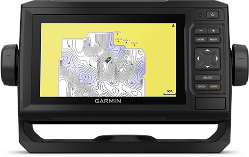
QUICKDRAW CONTOURS
Create personalised fishing maps on-screen with 1’ contours. Keep the data to yourself, or share it with the QuickDraw™ Community on Garmin Connect™.
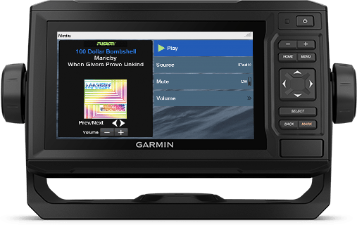
NMEA 2000® AND NMEA 0183 NETWORKS
Connect to autopilots, digital switching, weather, FUSION-Link™ audio system, media, VHF, AIS and more from one screen.
Specifications:
General:
- Dimension: 21.8 x 13.0 x 6.2 cm
- Weight: 0.7 kg
- Waterproof: IPX7
- Display Type: WVGA Display
- Display Size: 13.7 x 7.7 cm; 15.2 cm (6.2") Diagonal
- Display Resolution: 480 x 800 pixels
- Mounting Options: Bail or Flush
- Input: Keyed
Maps & Memory:
- Accepts Data Cards: 1 microSD™ Card; 32 GB Maximum Size
- Waypoints: 5,000
- Track Points: 50,000
- Tracks: 50 Saved Tracks
- Navigation Routes: 100
Sensors:
- GPS
- Has Built-in Receiver
- Receiver: 5 Hz
- NMEA 2000® Compatible
- NMEA 0183 Compatible
- Supports WAAS
Built-in Maps:
- Tide Tables
- Bluechart G3
- Optional Map Suppor
- Bluechart G3 Vision
- LakeVü G3
- LakeVü G3 Ultra
- Topo 100k
- Standard Mapping
- Garmin Quickdraw Contours
Chartplotter Features:
- AIS
- DSC
- Supports Fusion-Link™ Compatible Radios
- ActiveCaptain Mobile Planning Compatible: Yes
- Wireless Remote Compatible
- Sailing Features
Electrical Features:
- Power Input: 9 to 18 VDC
- Typical Current Draw at 12 VDC: 0.7 A
- Maximum Current Draw at 12 VDC: 1.25 A
- Maximum Power Usage at 10 VDC: 12W
Sonar Features & Specifications:
- Displays Sonar
- Power Output: 500 W
- Traditional Sonar (Dual Frequency/Beam): Built-in (Single Channel CHIRP, 70/83/200 kHz, L, M, H CHIRP)
- ClearVü: Built-in 260/455/800/1000/1200 kHz
Connections:
- NMEA 2000® Ports: 1
- NMEA 0183 Input Ports: 1
- Video Input Ports: None
- Video Output Ports: None
- Garmin Marine Network Ports: None
- 4-pin Transducer Ports
No reviews found